Alabama, Mississippi, slavery, and voting
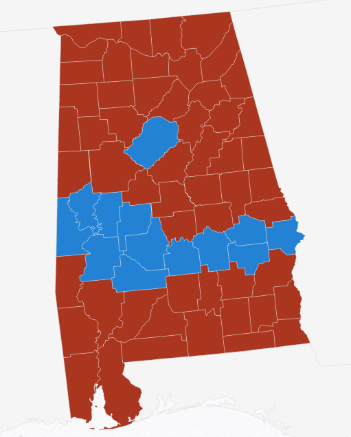
Posted: March 8, 2017 Filed under: America, politics, the world around us Leave a commentLook at this voting map of Alabama for President, 2016:
And this one of Mississippi:
Those are from Politico, 2016 county by county election results.
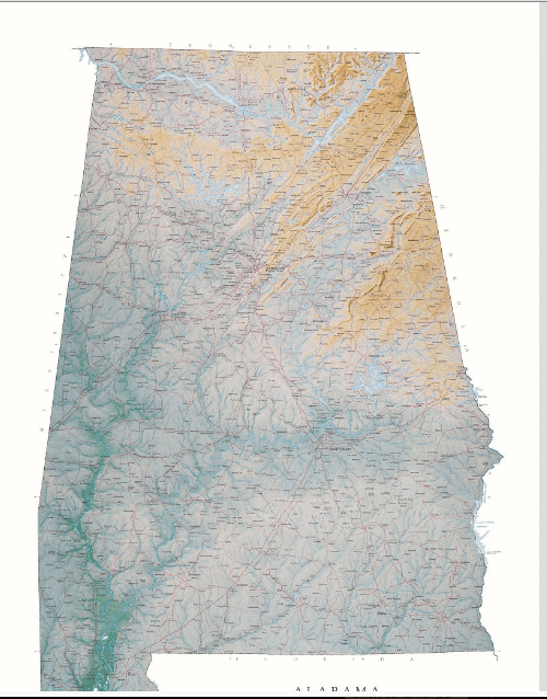
Compare them to these amazing Raven Maps (I love Raven maps, buy a Raven map) that show elevation:
Look at the Mississippi Delta:

My hypothesis is that the legacy of slavery can be seen in a simple voting map: black people still live in bottomland — cotton country.
You might double check that by looking at racial percentages by county.
No doubt there are factors I haven’t considered.
Compare too to this 1861 Coast Survey slavery map:

This might demonstrate:
- geography affects history
- historical legacies can last a very long time
- good maps are illuminating
